Mapping Data, Building Experiences.
Bridging the gap between complex spatial data and immersive digital experiences. I turn geospatial insights into tools that inform, engage, and matter.
About Me
I'm Andi Haidar Ali, a Spatial Analyst and Web Developer specializing in transforming complex geospatial datasets into compelling, interactive digital experiences. With deep expertise in GIS, remote sensing, and modern web technologies, I build platforms that make spatial data accessible and actionable.
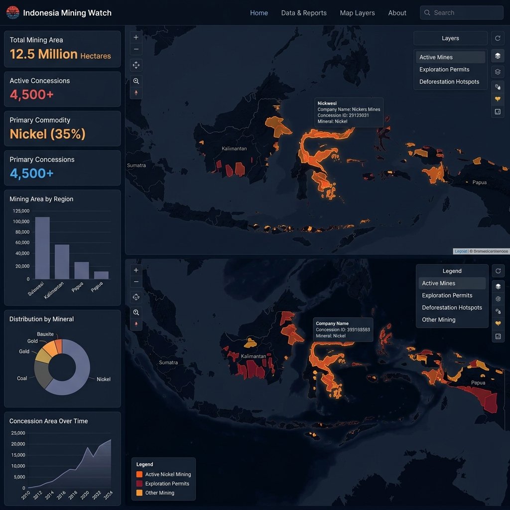
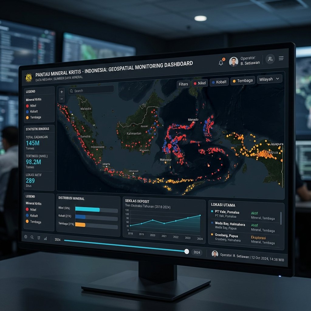
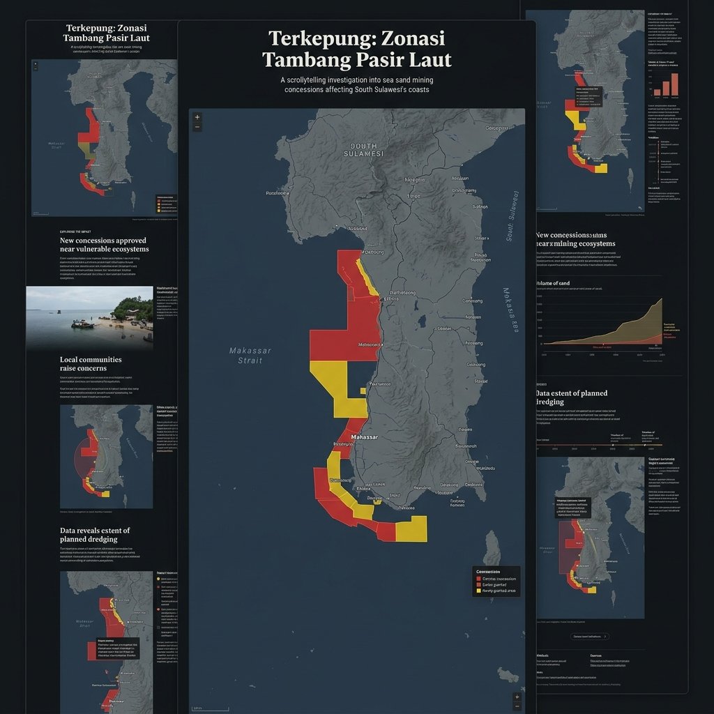
My work spans across environmental monitoring, investigative data journalism, and resource tracking β helping organizations and media outlets communicate complex spatial stories to the public through intuitive, data-driven web applications.
Skills & Tools
A comprehensive stack spanning geospatial analysis, web mapping, and full-stack development.
Portfolio
Scroll through an interactive journey across my geospatial and web development projects β each one rooted in a real place on the map.
Explore
Scroll down to journey across Indonesia β from the nickel-rich hills of Sulawesi to the contested coastal waters of Java. Each project is anchored to a real place and a real story.
Project 01 Β· Sulawesi
An interactive geospatial platform for monitoring mining concession areas across Indonesia. Focused on Sulawesi's rapidly expanding nickel mining zones, this platform visualizes mining permits, environmental overlaps, and community impact areas β putting critical data in the hands of researchers, journalists, and the public.
Project 02 Β· Indonesia
A national-scale monitoring dashboard tracking critical mineral reserves and concession data across the Indonesian archipelago. Built to support policy research and public transparency, this platform aggregates spatial data on nickel, cobalt, copper, and other strategic minerals essential to the global energy transition.
Project 03 Β· South Sulawesi
An immersive scrollytelling investigation published by Jaring.id exploring how sea sand mining concessions are encircling coastal communities in South Sulawesi. Combining spatial analysis with interactive journalism, this piece uses scroll-driven map transitions to reveal how extraction zones overlap with community fishing grounds and marine protected areas.
What's Next?
Every map tells a story. Whether you need a data visualization platform, an investigative spatial narrative, or a full-stack geospatial application β I have the skills to bring it to life.
Contact
Have a project in mind? I'd love to hear about it. Reach out through any of the channels below.
Whether it's an investigative data story, an environmental monitoring tool, or a spatial web application β let's create something meaningful together.
Send me an email